The background of this area should be an image. Please use Change Background feature to change the background of this area.
(Can be found under DESIGN tab)
Hiking Las Vegas Blog
|
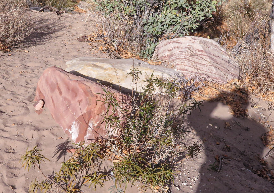
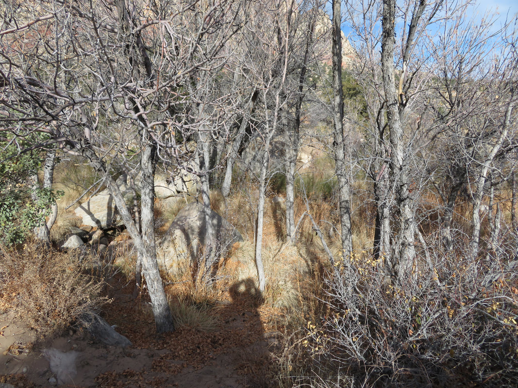
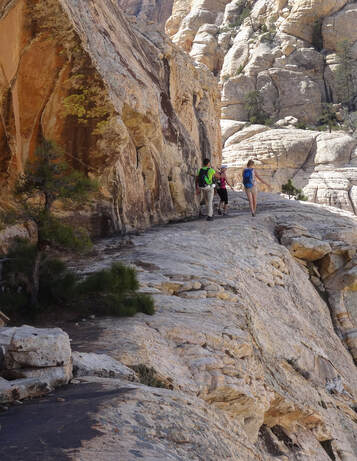
This is a quicker and more efficient way to White Pinnacle Gully. Follow First Creek Trail passing the turnoff for First Creek Waterfall. Continue on the trail as it turns into a path and spiderwebs. Stay near the wash, but do not cross it. Soon the path ducks under the branches of a large tree: Landmark 1 Shortly you will see a ~3 foot high tree stump to the left of the trail: Landmark 2 Finally, you will see the reddish boulder in the photo below: Landmark 3 Cross the wash here. See the photo below. You will ascend a very small hill after crossing the wash. Head NW about 50 yards where you will pick up a faint path. Follow this path the best you can. Although there are numerous paths, the direction of travel is now obvious: head for the slope that lies below White Pinnacle Gully
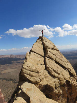
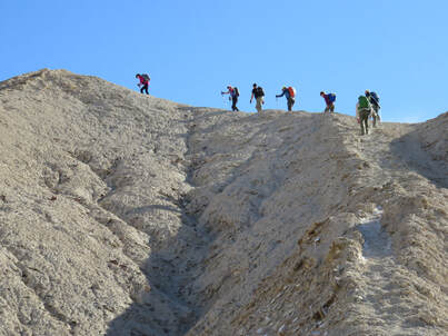
1. Fence Post Peak - maybe the most unique hike in the country. Doing the loop hike which includes climbing South Peak and the Overlook is the perfect hike. Such diversity in the terrain is mind blowing. All three summits are dirt, not rock! This hike should be done during the cooler months. Video of the hike. Location: China Date Ranch, CA 2. White Pinnacle Peak - walking out to the very exposed summit is something you will never forget. This is not a long hike, but there's plenty of scrambling before you get to the final exposed walk. You can start this hike anytime, since it's not along the Scenic Loop drive in Red Rock Canyon. Video of the hike Location: Red Rock Canyon 3. Bridge 360 - The route does a 360 around the dome of Bridge Mtn. This looks totally impossible from ever angle. The route involves a short rap. Location: Red Rock Canyon 4. Three Peak Hike in Death Valley - This is an excellent, round trip hike, that goes to three different peaks including Red Cathedral, Damn Fool and Manly Beacon. Video of the hike Location: Death Valley, CA 5. The Hideout - Exposed scrambling route to a area where someone was hiding out from...? In the video you will see old batteries, canteen and other artifacts. Video of the hike Location: Red Rock Canyon. 6. Monument Traverse - Super hardcore hike that travels to four peaks with a short rap. There's a tank when full it's more than 12 feet deep! Location: South Red Rock Canyon 7. Eva's Tower - great scrambling hike with incredible scenery. By doing an easy rappel you can shorten the descent route by 50%! Video of the hike Location: Red Rock Canyon 8. Ice Box Peak - The peak is like an island in the sky. There's no easy route to this one! Video of the hike Location: Red Rock Canyon 9. Boot Boulder - Short scrambling route to a boulder that looks like a boot! There's some exposed climbing on this route. Good winter hike. Location: Red Rock Canyon 10. Bridge Point SE Face Route - One of the toughest routes in Red Rock Canyon. Lots of class 4 and 5 climbing. It also has the coolest slot in all of Red Rock. Location: Red Rock Canyon. Over the last 23 years I have been exploring all over the Southwest and the above peaks and routes are the best I have found. Most of these peaks are less than 20 miles from the heart of Las Vegas!
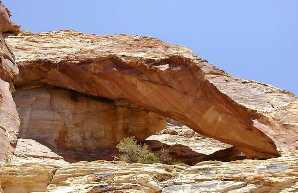
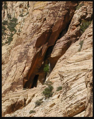
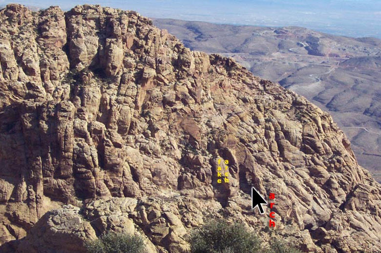
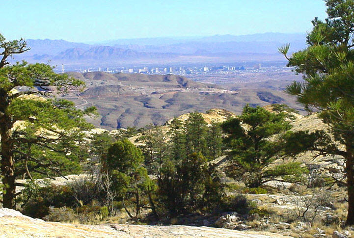
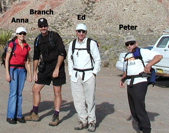
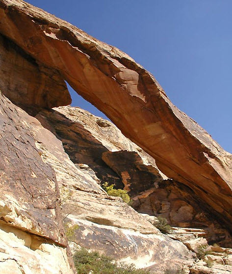
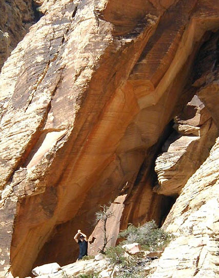
Some peaks that did not make the list: Pine Creek Peak, Terrace Canyon Peak, Oak Creek Overlook, First Creek Peak, East Peak, Hidden Peak, Black Velvet Peak, Windy SE Face, Magic Mtn, Tunnel Vision Peak, and Goodman Peak. The Monument Arch has been a quest of mine for several years. At first I thought it might be an illusion. (See photo below.) As time passed I forgot about it until Davis just happened to catch the Arch in a photo taken from Black Velvet Peak. After inspecting the photo, the hunt was on again! From previous hikes to East Monument Peak I was convinced the Arch was a technical hike (ropes) from the east. Davis and I figured we would approach it from the west, which meant hiking to West Monument and then somehow find a route down to the Arch. Not an easy task for an illusive Arch that might not exist! We obviously would need a good pair of hiking socks. Attempt 1On December 7th, 2001, Davis and I tried to find the Arch by ascending to West Monument and then descending the Gully of Death. About halfway down the gully the sun started to sink and we got out of there. Attempt 1 was a dismal failure. The only thing we learned was this was going to be a long hike. Also, we learn that our combined IQ's during the hike didn't reach into double digits :) Attempt 2On an early and cold morning in January, Davis and I tried again to find the Arch. This time our trailhead was off of Lovell Canyon road, the same trailhead for "The Park" hike. We figured this was a quicker approach than from Black Velvet trailhead. We hiked to West Monument and started the descent. Once past where we turned around last time, the going became tough. It was loose and brushy and death was in the air or, at least, a minor scrape from scrub oak! Finally, we were just around the corner from the Arch. We turned the corner and... No Arch, it was an illusion! There was an Arch type structure without the Arch. Maybe in a few thousand years it will become an Arch. I don't think we'll wait. We were disappointed to say the least. I wouldn't have believed it unless I saw it with my own eyes. Photos Don't Lie We tried to return the camera that took the photo of the Arch claiming it was defective. The store manager promptly threw us out of the store. We looked at the photo again and realized we were defective. We had stopped about 75 yards shy of the real Arch. We were almost 100% sure there was an Arch. We planned to wait until the longer days of April to conquer the Arch. Attempt 3On a warm day in mid-April we started at Black Velvet trailhead on our quest to stand in the Arch. We both agreed the hike in from Black Velvet was better than the hike in from Lovell Canyon road. It didn't matter to us that it was longer. As we approached the "Ledges" Davis hurt his ankle. Having watched several episodes of Marcus Welby, MD when I was a kid, I offered to operate on it. Davis declined. The Arch got us again! I think it was smiling! Attempt 4On May 14th, 2002, we were certain the Arch was ours! We were both in good shape and the daylight stretched into the evening. We departed from Black Velvet trailhead, ascended to West Monument, and descended the Gully of Near Death. This time we walked the additional 75 yards and... there was the Arch. The only thing that separated us was a 60-foot, class 5, wall! Where did that come from? It was not apparent in Davis' photo. We both collapsed. I am sure the Arch was laughing at us. Time to Bring in the ProfessionalEd Forkos has been climbing mountains for 40 years. He's very knowledgeable and puts safety first. I told him about the Arch and he wanted to conquer it. Bringing ropes and webbing with him, we planned to approach the Arch from the east and descend into a ramp that leads to the Arch. From my previous trips I knew if we could get to the ramp, we had it made. I talked Peter and Anna into coming along. Suckers! On Halloween 2002, the four of us started walking toward East Canyon in our hiking costumes on route to the Arch. On an previous hike I had descended Arch Canyon, so we decided to climb it instead of following the traditional route. Part of the climb was very exposed class 4. Once near the Arch, I showed Ed all the routes down to the ramp and we decided on one. After finding an appropriate anchor, Ed tied me into the 100-foot rope and I started descending to the ramp. Peter thought it would be a good idea to tie the rope around my neck. I disagreed and kicked him off the hike. (I kick him off every hike :) I believed it was going to be a class 3 descent. I was wrong! It was class 4, at least. The rope was very reassuring. I inched my way down to the ramp and started running toward the Arch. Slam! I forgot to untie the rope. Thankfully it wasn't around my neck :) After untying the rope, I walked to the Arch. Wow! It was taller than I had thought. I was finally standing in the Arch. The Arch is NOT on topo maps. I believe we were the first to stand in the Arch. I have never talked to anyone who knew about the Arch. We figured the Arch was at least 100 feet tall. It's more impressive than the Arch at Bridge Mountain. Current TimesToday only a handful of people have stood under the arch. To my knowledge I am the only person who has led this hike. We now rap down to the arch. This is safer and faster.
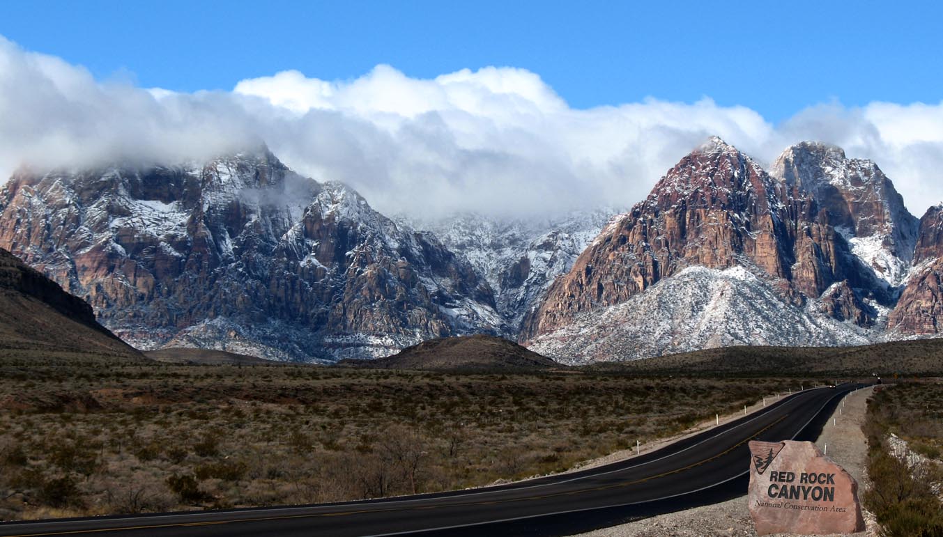
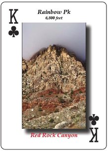
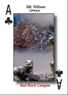
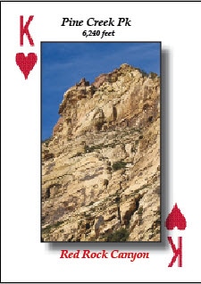
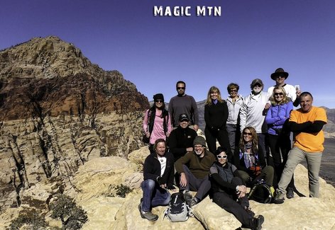
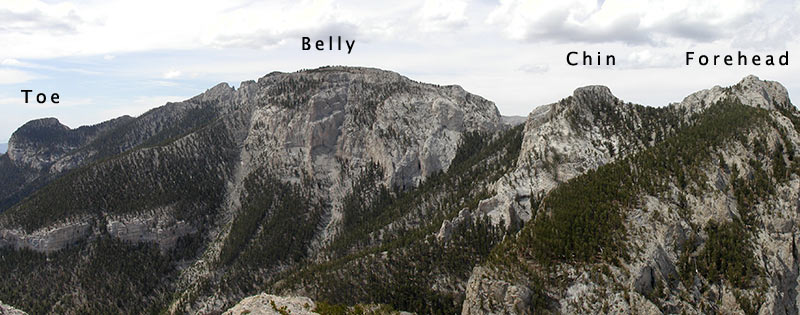
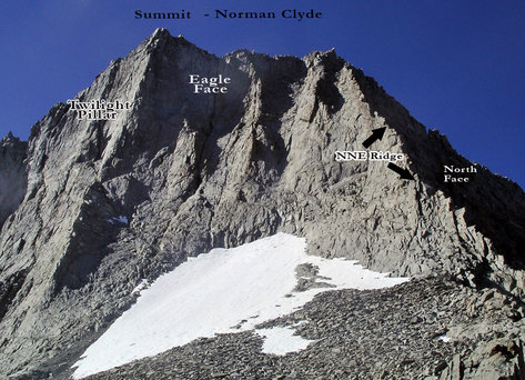
I had the arch registered in a database of natural arches around the country. This is one of many stories of how I and others found peaks and points of interest in Red Rock Canyon. On March 12th Daylight Savings Time begins. This marks the prime-time to hike in Red Rock Canyon. It will not get dark until 7 pm, the same time the Scenic Loop Road closes. The snow has melted and the ice is gone! However, the washes still have water in them, making for a scenic hike. All of the above factors make this the prime-time to hike in Red Rock. This is your best bet to do the longest and toughest hikes in Red Rock. Here's my list of some of the toughest hikes in Red Rock: 1. Rainbow Peak - no easy route to the summit. The shortest route is: Rainbow Peak Without the Ledge. This route has lots of Class 4 sections and ropes. STATS: Distance 7 miles; Elevation gain: 3,072 feet 2. Mt. Wilson - highest sandstone peak in Red Rock. The elevation gain is over 3,000 feet. The shortest route is Cleaver Crack, but there are plenty of very steep sections, since the distance is shorter than other routes, but the elevation gain is the same. Video of the hike. STATS: Distance 8 miles; Elevation gain: 3,014 feet  3. Pine Creek Peak - A cool peak located at the back of Pine Creek Canyon. Lots of scrambling and exposure on this awesome route. Video of the hike. STATS: Distance 7.5 miles; Elevation gain: 2,845 feet Remember a mile of scrambling equals two miles for trail hiking! Did you know the 52 Peak Club leads all of these hikes? Check them out here. Do you agree my picks? Let me know in the comments. Thanks for reading, Branch Magic Mtn. is a local favorite hike in Red Rock Canyon. It's one of the best, short scrambling hikes in Red Rock. It's also a round-trip hike! Below is my video review of the hike. It's a moderate hike that starts on a trail before scrambling to the summit. Hikers who can handle class 3 climbing and are in moderate shape can do this hike. The 52 Peak Club offers this hike frequently to members. I give this hike 5 stars! Red Rock Canyon stands just 20 miles west of Las Vegas, NV. What most people don't realize is there are three separate hiking areas. Let's look at them. Calico Basin/Red SpringCalico Basin/Red Springs is just north of what most people call Red Rock Canyon. Access is off of SR 159 about two miles before Red Rock Canyon. The hikes are short and relatively easy. The established trails are few and not well marked. Some of the popular peaks in this area include: Calico Tank Peak, Kraft Mtn, Gray Cap Peak and Turtlehead Jr. Peak. There is no fee to enter and hike in this area. It is crowded, especially during the weekend. There is a pavilion area with tables, chairs and restrooms. Red Rock Canyon - Scenic LoopThis is the area most people visit at Red Rock. Access is off of SR 159. The hikes range from easy to very difficult. There are 19 established trails (BLM) and the only peak the BLM recognizes is Turtlehead Peak. There are many challenging peaks in this area including: Bridge Mtn., Juniper Peak, Rainbow Peak, White Rock Hills Peak, Ice Box Peak, Pine Creek Peak, Oak Peak, Terrace Canyon Peak, Crabby Appleton Peak, Bridge Point, Mt. Wilson (highest sandstone peak in Red Rock), and Mescalito Peak. There is a fee to drive on the 13 mile Scenic Loop road: $7 per vehicle, per day; $30 Red Rock Annual Pass $80 America the Beautiful Annual Pass - good for all national parks. There is a Visitor Center just beyond the fee booth. It is crowded, especially during weekend. Try to arrive before 11 am to avoid waiting to get through the fee both. South Red Rock CanyonThis is the least known part of Red Rock Canyon. Access is off of Blue Diamond Road aka SR 160. Most of the hikes are difficult. There are very few established trails. There are many challenging peaks in this area including: Black Velvet Peak, East Peak, Hidden Peak, Global Peak, Windy Peak, and The Stealth Range. There is no fee to enter and hike in this area. There are no amenities. It is not crowded. Helpful Links:How tough are you? If you’re tired of the same easy trails and long for a greater sense of adventure then we’ve got a treat for you – five of the toughest hikes in the SW. These trails will give you a real test, just be sure you’re physically up to the challenge, have suitable gear (including the ten essentials) and are determined to take mother nature on. Try these hikes and find out how tough you really are: 1. Mummy Head to Toe It's a traverse across Mummy Mtn in Mt. Charleston, which is near Las Vegas, NV. During the adventure you will stand on four different peaks. Stats: Distance: 8.5 miles Elevation gain: 4,129 feet Elevation of peaks: Mummy’s Forehead 11,040, Mummy’s Chin 11,037 feet, Mummy’s Tummy 11,542 feet, Mummy’s Toe 10,925 feet Time: all day Class: 4+ What makes it so tough? No trail, four peaks and traversing around 11,000 feet for most of the day. (There's a five peak variation) Inside info: Watch for loose rock. A car shuttle is required. 2. Norman Clyde One of the toughest peaks in the Sierra and named after the most prolific mountaineer of the Sierra. Stats: Distance: 13 miles – round trip Elevation gain: 6,160 feet Elevation peak: 13,920 feet Time: Long day or backpack Class: 4 What makes it so tough? It's a steep climb at high elevation and it's cold even in August. The route ascends the North Face. Inside info: Attempt in late August/early Sept. Bring gloves and rap gear. 3. Four Peak Scramble in Red Rock Canyon This is possibly the toughest rock scramble in the country! With virtually no trail it's all scrambling to four very different peaks: Juniper, Gunsight Notch, Rainbow and Mt. Wilson. Each of these peaks is a good hike; all four in one day is a killer hike. Stats: Distance: 9 miles – round trip Elevation gain: 7,160 feet Elevation peak: Juniper 6,109 feet, Gunsight Notch 6,200 feet, Rainbow 6,800 feet, Mt. Wilson 7,070 feet Time: A very long day Class: 4+ What makes it so tough? Massive elevation loss after Juniper and Rainbow peaks. The toughest peak (Mt Wilson) is the last peak of the day! Inside Info: Cache water before attempting this hike. 4. Mt. Sill Another Sierra Peak with possibly the best vista in the Sierra! This is a very tough climb. Check out the stats below. Stats: Distance: 20 miles – round trip Elevation gain: 6,300 feet; Elevation peak: 14,136 feet Time: Long day or backpack Class: 3/4 What makes it so tough? 20 miles and 6,300 feet in gain. Do I need to say more? Inside info: Most camp at Sam Mack Meadows. This breaks up the climb. It's a trail hike to Sam Mack Meadows. 5. Badwater to Telescope Peak
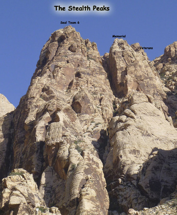
Many hardcore hikers consider this the toughest hike in the country. You start at sea level and ascend to 11,049 feet! That's a lot of elevation gain. The hike is called Badwater to Telescope, but most start at Shorty's Well. It cuts out about four miles of walking across the desert in the middle of the night. Stats: Distance: 21 miles (from Shorty’s Well to Mahogany Flats Trailhead) Elevation gain: 11,300 feet Elevation peak: 11,049 feet Time: 12 to 16 hours Class: 2 What makes it so tough? Gee, do you really need me to tell you? Also, logistically this is not an easy hike. Most hikers have a car at Mahogany Flats trailhead to make the hike shorter; otherwise, you have to retrace your steps descending 11,000 feet. Inside info: Do this hike in October and start around 2 am. Bring a gps. You want to intersect the official trail at a saddle to avoid a terrible scree field. Here are five secret hikes that you probably haven't done. You will want to do these hikes after reading this article. These hikes are located in Red Rock Canyon, just 20 miles west of Las Vegas, NV. 1. Lost Creek Peak via the Ridge Route This is a crazy hike with tons of class 4 scrambling. It features the amazing Graffiti Traverse! Check out the video below. This is a long hike. Stats: Distance: 6 miles (no trail at all) Elevation gain: 2,100 feet Elevation peak: 6,644 feet Time: 6 to 7 hours Difficulty: 4 Class: 4/5 2. Tunnel Vision Peak via the Original Route After years of hikers abandoning this hike, it's back. We found a work-around the bees, which makes the hike even better! Lot's of ropes on this route and they are needed. Stats: Distance: 4 miles - Up and back Elevation gain: 1,700 feet Elevation peak: 6,100 feet Time: 5 to 6 hours Difficulty: 3 Class: 5 with ropes 3. The Stealth Range If you have hiked in Black Velvet Canyon, you have seen these awesome looking pinnacles. At times they seem to disappear and then reappear. Each pinnacle is mind blowing. Come prepared with ropes and a harness. There are at least three raps. Stats: Distance: 7 miles - Up and back Elevation gain: 2,507 feet Elevation peaks: ~6,100 feet Time: 6 to 7 hours Difficulty: 4 Class: 4 4. South Summit of Mt. Wilson This summit is different than Mt. Wilson. It has a cool ledge just below the summit that looks straight down 2,000 feet into the void. The route first travels to White Pinnacle Peak, one of the best summits in Red Rock, but you already know this! Stats: Distance: 8 miles — up and back Elevation gain: 3,064 feet Elevation of peak: 6,791 feet Time: 6 to 8 hours - Up and back Difficulty: 5 Class: 4 5. Walk Up Wall This route goes through the amazing Gunsight Notch before scaling an intimidating wall to the summit. Once at the summit you are looking at the upper part of Rainbow Wall. Stats: Distance: 7.5 miles – round trip Elevation gain: 2,550 feet Elevation peak: 6,660 feet Time: 5 to 6 hours Difficulty: 4 Class: 4 (very exposed) 2 Smart Ways to Do These HikesThese hikes are very hard to follow. There's no signs, no trails to the summits. There's only one hiking group that does these hike and that's the 52 Peak Club.
If you are the type that likes to do these hikes with your hiking buddies, then you can become a VIP of this website where you can download the step by step directions with GPS waypoints. Note: The Stealth Range is not available for download at this time. All of these routes were found by the 52 Peak Club. On Feb. 7th, the 52 Peak Club did a hike to First Creek Peak. Normally this is a fun hike with lots of scrambling, but on this day there was ice high up on the route. Not surprisingly the ice was on the north facing side. This made things tricky and safety was the utmost thing on our minds.
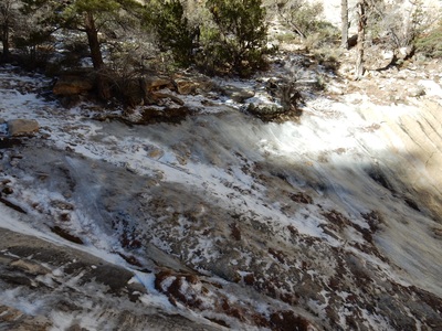
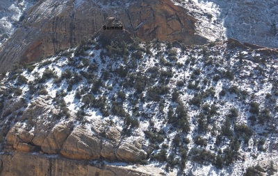
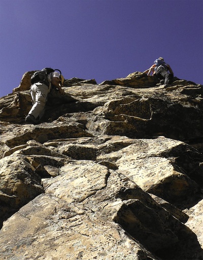
Things Get Tricky and We Used Some Tricks The higher up we climbed the more snow and ice we encountered. Luckily we were in fairly tight chutes, so we could use the walls for handholds and there was no exposure. Once we turned the corner and came to the ledge things changed. Ahead of us was a very exposed climb that had ice on it. A fall here would be deadly. Walking the ledge normally was no big deal, but with ice on it and a death-fall off to the right, it was a big deal. We were close to the summit and did not want to turn around. We took rocks and started chipping away at the ice to the sandstone rock underneath. It worked! We carefully and successfully traversed the ledge. At one point we laid down a roped to make it safer. Summit Block After carefully hiking up the snow covered ground, normally this is an easy hiker's path, we stood at the base of the imposing summit block. We were all glad there was no ice or snow on this final climb. At the summit we rested, it had been a tough hike and looked across the canyon to the Hidden Bowl on Mt. Wilson. Not a speck of snow or ice, since it was south facing. Hmm... Decision Time We all realized descending the route we ascended would be very tricky and dangerous, even with webbing and cams. Most accidents happen during the descent. We made a group decision to traverse over the Hidden Bowl. The traverse was long, but very safe. We descended the Hidden Bowl back into the wash. Bottom line is we all made it out without incident and had a memorable hike. Better decisions lead to better hikes and a better life. This one example.
|
AuthorBranch Whitney is the author of Hiking Las Vegas and creator of the 52 Peak Club where members hike to the best 52 Peaks around Las Vegas, NV Archives
October 2023
Categories |


 RSS Feed