The background of this area should be an image. Please use Change Background feature to change the background of this area.
(Can be found under DESIGN tab)
Hiking Las Vegas Blog
|
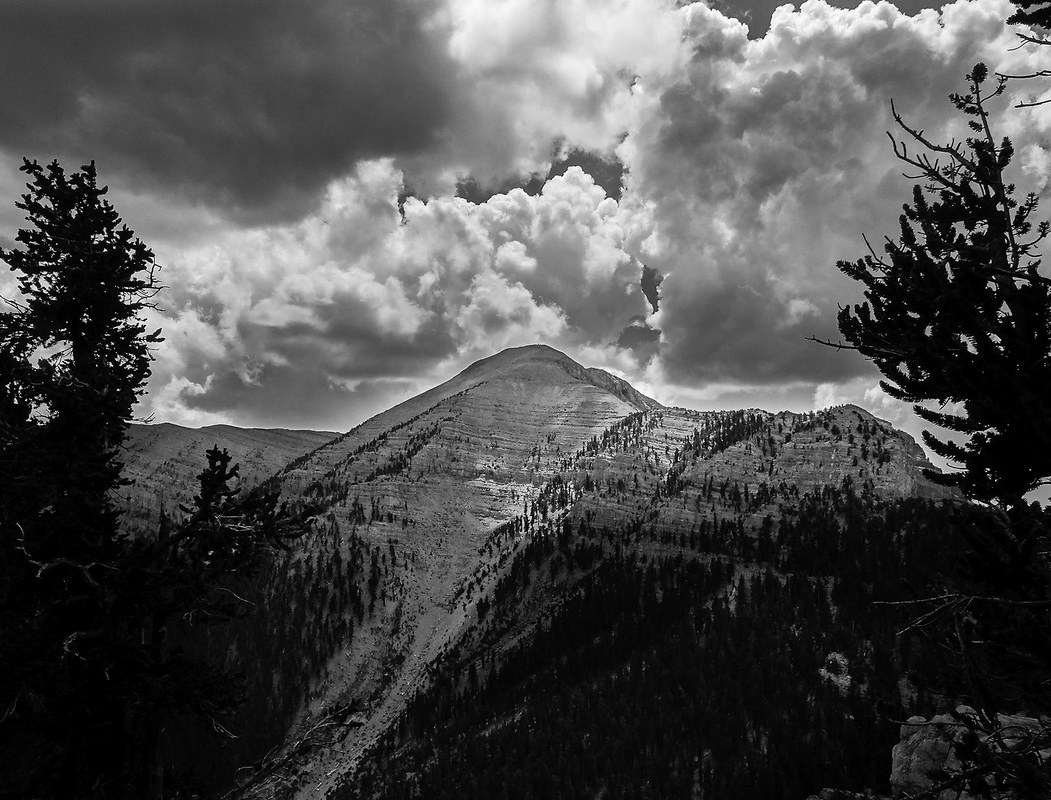
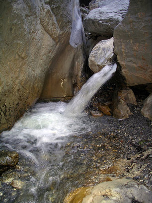
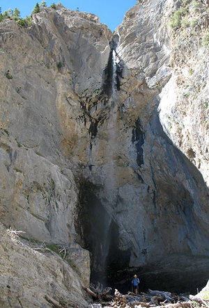
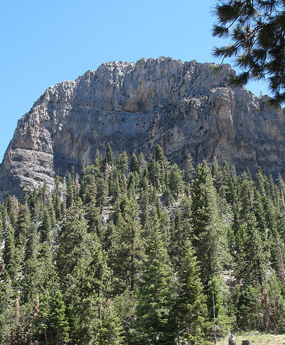
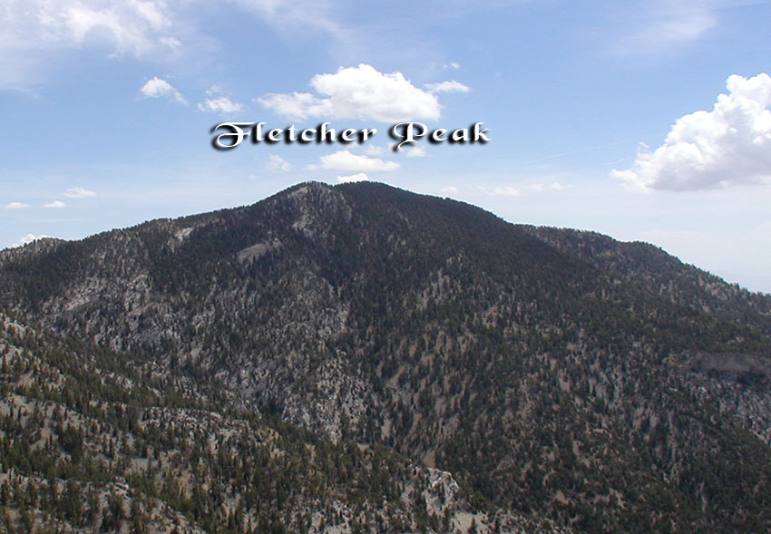
Due to the higher elevation in Mt. Charleston (the lowest hikes start at 7,000 feet and higher), you want to start off slow and do easier hikes at lower elevations. Depending on the amount of snow, you can start hiking in Mt. Charleston in April or May. Mt. Charleston is only 35 miles NW of the Las Vegas Strip. Your First Hikes:Fletcher Canyon: A local favorite and perfect for your first hike. It starts at a lower elevation than other hikes in Mt. Charleston and only gains 600 feet over two miles. The trail is easy to follow and has lots of water and sometimes snow in the late spring. This hike will not disappoint! Stats: Distance: 4 miles - up and back Elevation gain 600 feet Time: 2 hours - up and back Difficulty: 1 Class: 2 Raintree: This hike travels to a 3,000 year old Bristlecone Pine, the oldest living thing in the region. The tree has been named Raintree. You’ll hike up to 10,200 feet, which is substantially higher than the other hikes so far. It’s all trail and easy to follow; however, Raintree is not signed. Stats: Distance: 6 miles — round trip Elevation gain: 1,100 feet Elevation highest point: 10,200 feet Time: 3 to 4 hours — round trip Difficulty: 2 Class: 1 Big Falls: This is a must do hike than ends at a 100 foot seasonal waterfall. During late spring you will most likely hike on snow, which actually makes the hike easier. Since the trail ends in the drainage, there’s some bouldering before the waterfall. Stats: Distance: 3.50 miles – up and back Elevation gain: 800 feet Elevation highest point: 8,700 feet Time: 2 hours – up and back, plus time spent at Big Falls Difficulty: 2 Class: 2 Ok, It's Time to do Your First PeakCathedral Rock offers great views from the top and follows an established trail. It’s another very popular hike. If possible, try avoiding hiking on the weekends. This hike should be done in late May or June. You don’t want to do this hike earlier in the year with snow on the trail, unless you are competent hiking in snow. Stats: Distance: 3 miles Elevation gain: 900 feet Elevation peak: 8,600 feet Time: 2.5 hours — up and back Difficulty: 2 Class: 1 After doing the above hikes you should be adjusting to the higher elevation in Mt. Charleston. Now it’s Time to Tackle the Big Boys! Fletcher Peak soars over 10,000 feet into the air and has some of the best views of any peak in Mt.Charleston. The hike is all trail except for the last 100 yards making it very easy to follow. Stats: Trailhead: North Loop — marked Distance: 7.25 miles — up and back Elevation gain: 2,214 feet Highest elevation: 10,319 feet Time: 3 to 4 hours — up and back Difficulty: 3 Class: 1 After hiking Fletcher Peak you are ready for Mummy Mountain and Charleston Peak, the highest summit in southern Nevada. There are several routes to both peaks. Some of the routes have class 3 or class 4 climbs to reach the summit. Try to do these hikes before late July. You’ll read why in the section called: Dangers Clothing, Food, and EquipmentClothing helps you stay dry and comfortable. How do you prevent becoming chilled? Wear layers of clothing. The secret to layering is combining the correct clothing in the proper order. Done correctly it traps air warmed by your body heat while wicking moisture away from your skin. The first layer (the one closest to your skin) will wick moisture away from your skin while trapping body heat. Any of the wicking fabrics found under the trade names Thermax or Coolmax work well. They come in different thickness. The colder the climate, the thicker the material you will want. The middle layer acts as insulation. Fleece sweats, polypro pullovers, or a long-sleeved flannel shirt are good choices. The middle layer can be more than one garment. The final layer protects from wind. A windbreaker is fine, except during winter months in Mt. Charleston. Jackets made from GORE-TEX are recommended during winter. If you become hot, simply peel some of the layers. If you become cold, add layers. I bring a rain jacket when hiking in Mt. Charleston. It can double as a windbreaker. You lose more heat from your head than any other part of your body. A Balaclava, sort of like a ski mask, will keep your head warm and is lightweight. Hiking Shoes/Boots I do not wear mid-weight boots. I use to and found them to be heavy and really not needed. I wear old approach shoes, ones that the soles are too beat up for Red Rock. The rock (limestone) in Mt. Charleston will tear up sticky rubber soles very fast. Hike Mummy mountain’s scree slope once and you will know what I mean. If you do not have a pair of old approach shoes, then buy lightweight hiking shoes that do NOT have any type of sticky rubber. These shoes are generally less expensive and you will not ruin the soles. Items you should have in a first aid kit: Triangular bandage Ace bandage Band-Aids Tape 1 inch roll Moleskin or Spiroflex (for blisters) Aspirin and pain medicine Sunscreen Tweezers Food and Water: Water: Due to the elevation it’s easier to get dehydrated. If doing advanced hikes, bring at least 3 liters of water, which is a full bladder. Food: Bring food that will give you energy. Fruit, energy bars, and trail mix are good choices. Dangerslthough there are not many dangers while hiking in Mt. Charleston (no bears or venomous snakes), there is the ever present Monsoon season, which rears its ugly head normally in late July and last most of August. The Monsoon season are violent thunderstorms with lots of lighting that start around noon. The wind can pick up and the temperature can drop drastically. What’s the best strategy? Watch the sky and be prepared. If it looks like a thunderstorm is kicking up, turn around and get off the mountain. It will be there tomorrow. What should I do if caught in a thunderstorm? * Get off of peaks and ridgelines. * Stay out of shallow caves. * Stay away from water. If a trail turns into a stream, stay off. * If you're hiking with a group, spread out. * Stay away from tall objects (trees). * If you feel charged, squat down on non-conductive material. Your daypack is normally a good choice. * The best rule of thumb is to watch the sky and listen to the weather forecast the night before hiking. Rock Fall Mt. Charleston is known for loose rock. You need to be extra careful if hiking in a big group (8 + hikers). Here are some safety tips:
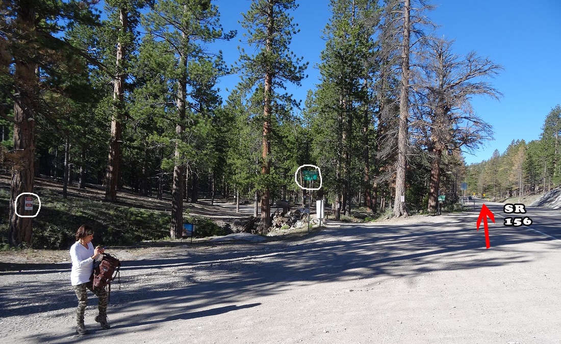
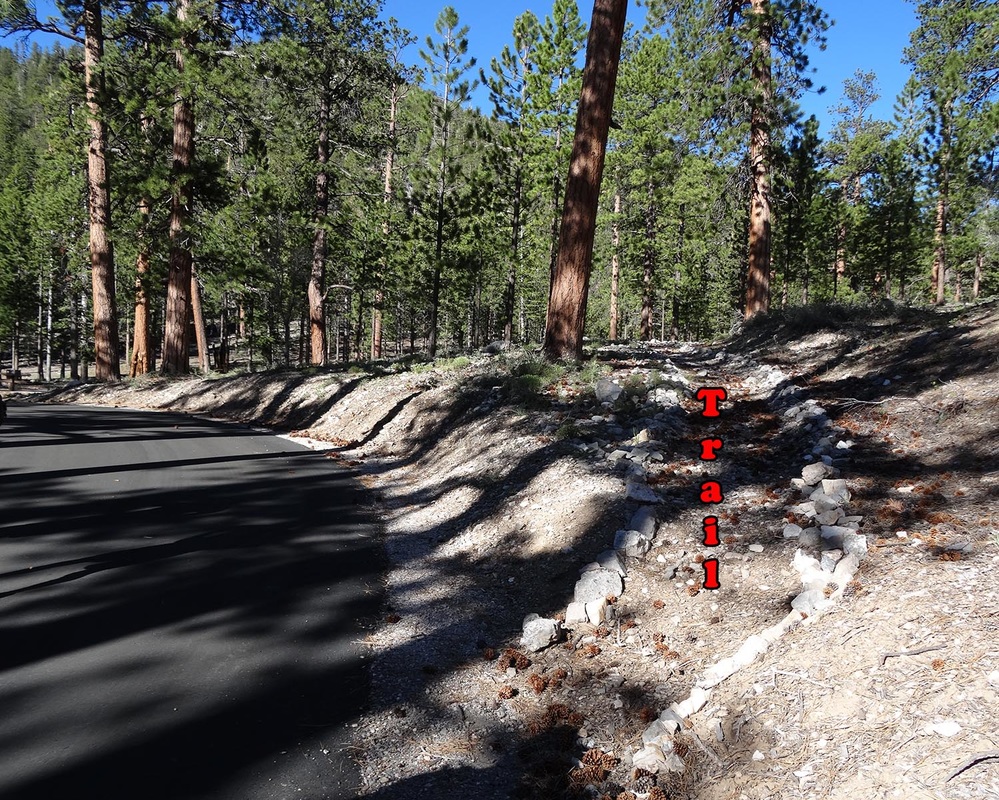
Well, now you have a strategy when it’s time to head for the alpine like peaks in Mt, Charleston. You also know what to bring and how to avoid dangers. All I can say is: take a hike! Want to join the best hiking club in Las Vegas? Check out the 52 Peak Club. For years hikers would descend a very loose slope from the summit of North Sister. This was dangerous due to hikers accidentally knocking down loose rocks. Last year (2015), I found a safer way to descend. It's not perfect, but it is better. In a nutshell the new descent follows a rocky ridge down about 60 yards from the summit and then descends a class 3 down climb into the loose slope as the original route. This new descent avoids the top half of the slope making it much safer. Caution still must be used since the second half of the descent travels down the same loose slope. Below is a video showing the descent. The descent is used for both the normal route (Old Mill Trailhead) or the route from Mack's Canyon road. Old Mills TrailheadOld Mills Picnic Area is still closed. You can't park there. You can park at a large gravel pulloff about 0.25 miles before the turnoff to Old Mills. It's on the south side of SR 156. See photo below. This is legal and there's plenty of room. There are trespassing signs, but they only apply if you hike south into the woods. Old Mills TH is north and west from where you park. The HikeThe start of the trail has changed slightly. In my write up (VIP Section) I state you walk about a half mile along pavement to where the pavement ends. The pavement has been extended, but the unsigned trail is pretty obvious. See the below photo. If you park outside of Old Mills Picnic area, you are going to walk more than a half mile, but it really doesn't matter since this is a round trip hike. The route is in good shape. Although the path you take from the main trail is faint for the first 25 yards it becomes easy to follow all the way to the saddle. From the saddle to the ridge the path is very faint, but direction of travel is obvious. Once on the ridge the path is easy to follow to the class 3 climb that lies just below the summit of South Sister.
I learned one trick as we follow the cairned route from South Sister to North Sister. Once past the exposed traverse, which is just beyond the arch, veer right instead of left. This is shorter and avoids a down-climb. This is one of my favorite routes in Mt. Charleston and now it's safer. I prefer starting at Old Mills rather than Mack's Canyon road for three reasons:
Find out more information about the 52 Peak Club here. Short answer: Yes! If I stop here, it would be a short article :) Like most things in life it depends on factors. Hiking, especially peak bagging, is very tough on the body. Around Las Vegas, you are either scrambling to the peaks or doing fairly long hikes in Mt. Charleston to the peaks. Red Rock hikes are especially tough on the upper body and knees. There's lots of climbing and maneuvering through tight spots that can be rough on shoulders. Descending steep standstone can be very tough on knees. The hikes to the peaks in Mt. Charleston are on the long side, ranging from 8 to 16+ miles. The constant pounding puts a lot of stress on the lower back, ankles and feet. Some of these hikes can also be tough on the knees. Most of these hikes range from four to eight hours! That's a long time to exercise. How many times do you workout four or more hours in the gym? And, unlike the gym, you can't choose to work certain muscles, giving other muscles a rest. The above reasons are why I think you can hike too much. The name of the game is longevity. There's not much to admire about someone who stopped hiking in their forties, because they overdid it. The person to be admired is the person going strong in their seventies. The million dollar question: How much is too much? That's impossible to say. What I can tell you is to listen to your body. If you are really hurting, then take some time off. The mountains are not going anywhere.
|
AuthorBranch Whitney is the author of Hiking Las Vegas and creator of the 52 Peak Club where members hike to the best 52 Peaks around Las Vegas, NV Archives
October 2023
Categories |




 RSS Feed