The background of this area should be an image. Please use Change Background feature to change the background of this area.
(Can be found under DESIGN tab)
Hiking Las Vegas Blog
|
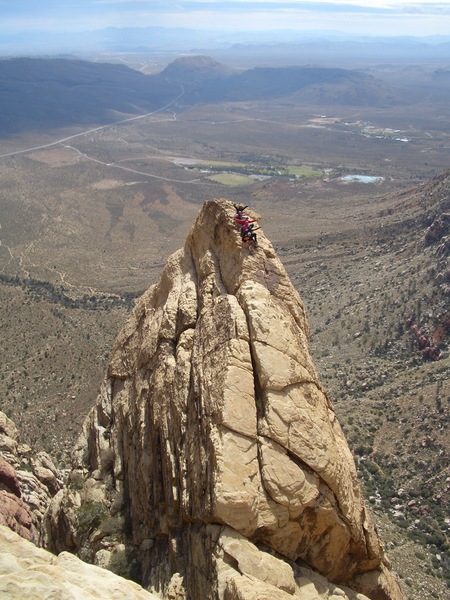
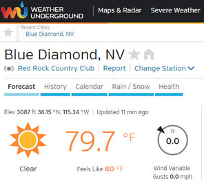
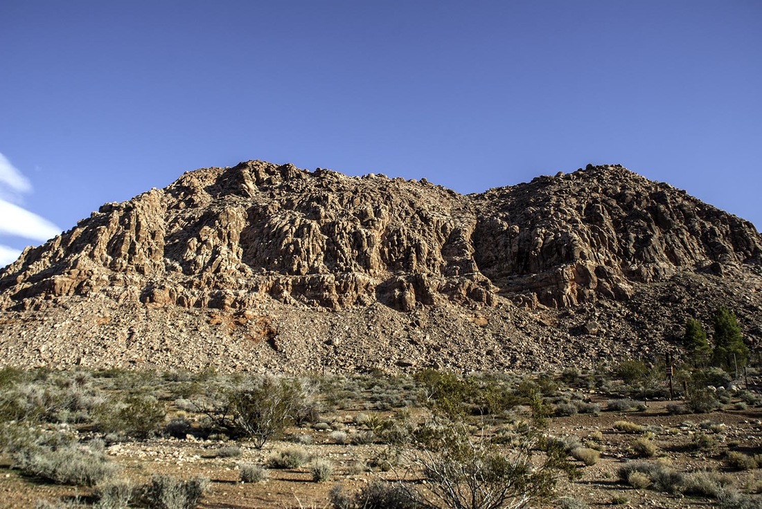
Doing White Pinnacle Peak in August sounds crazy. Everyone knows it's 120 degrees in Vegas during August. I led a hike to White Pinnacle Peak on August 27th, 2016. Let's see if this was a smart thing to do. It has never been 120 degrees in Las Vegas and August is not the hottest month. Hike Based on the Forecast, Not the MonthYes, August is normally a hot month, but on August 27th, 2016, the high temp in Las Vegas was 90 degrees and that was around 5 pm. That's 12 degrees below average. The elevation of Las Vegas is around 2,000 feet. We were not hiking at 5 pm and we were hiking at an elevation much higher than 2,000 feet. We started our hike at an elevation of 4,000 feet and climbed to 5,500 feet. "You lose almost 4 degrees for every 1,000 of elevation you gain" Let's Do the Math!5,500 feet - 2,000 feet = 3,500 feet 3500 x 4 = 14,000 or 14 degrees It was 14 degrees cooler at the peak than in Las Vegas. But there's more! We were not hiking at 5 pm, the hottest part of the day. We started hiking at 6 am. It's much cooler in the early morning than at 5 pm. At 6 am it was in the low 70's at the trailhead for White Pinnacle Peak. It was never warmer than 80 degrees the entire hike. That's almost 50% less than the claim of 120 degrees! Here's the best source for weather forecast for Red Rock Canyon: https://www.wunderground.com/q/zmw:89004.1.99999 Bottom Line:Watch the forecast, get early start, and pick your day correctly and you can hike on days that normally seem too hot or cold. The weather around Las Vegas varies wildly at times.
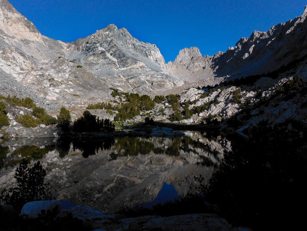
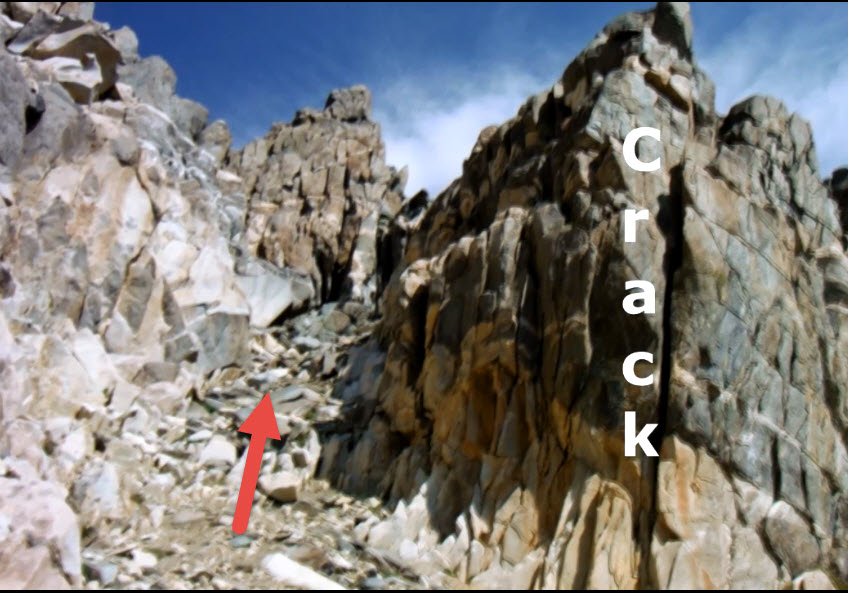
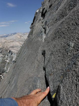
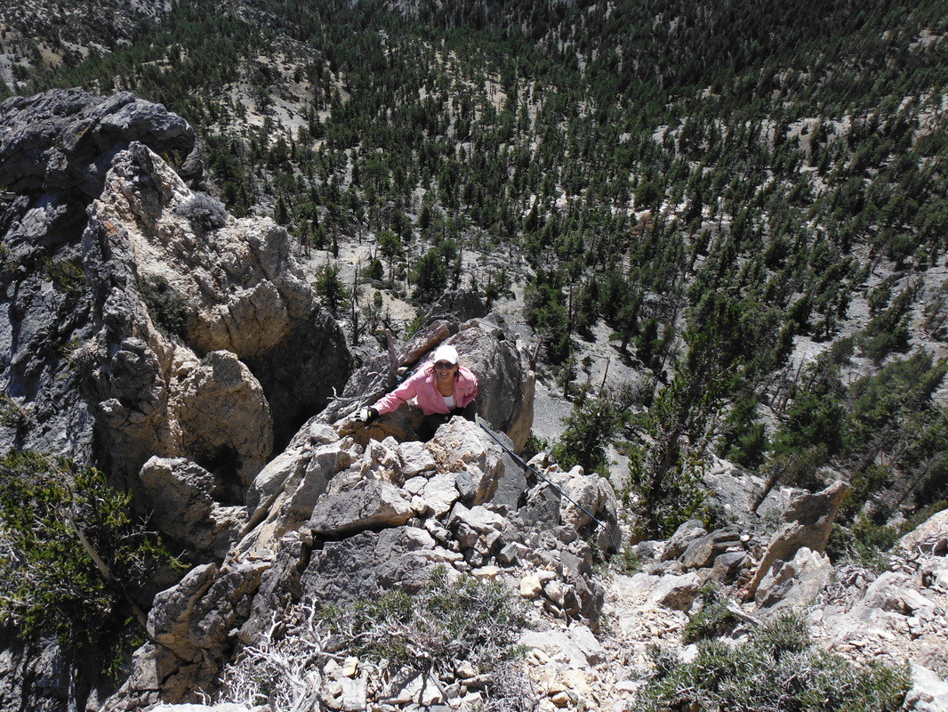
Have fun, stay safe, and make good decisions, Branch Wow! Why would it take someone 15 years to climb Dragon Peak? Because California Department of Fish and Game closed the area around Dragon Peak and several other peaks for years. Actually, the closure was from July 1st to December 15th. That meant you had to climb Dragon with snow and ice on the route. I was not willing to climb exposed class 3 rock with snow and ice. Fortunately, that restriction was lifted in 2014. I had been eyeing this peak since 2000. 2014 Not HappeingTwice I tried to climb Dragon Peak during the summer of 2014 and failed! During the first attempt we got off route resulting in an extra 1,000+ feet of elevation gain. Once in the final gully we took off too soon to the north and climbed until we were looking at a steep section of class 5 rock. That was it. I was beat physically and mentally. A few weeks later we tried again armed with better beta. At around 10,000 feet I became weak and dizzy. I had been drinking water and eating. I waited at the second unnamed lake as two other parties attempted Dragon Peak. One party made it; the other did not. 2016: Success!After losing 30+ pounds, getting into very good shape, and having some good beta I tried again. This is a great mountaineering route. It's scenic, has fun and airy climbing and can easily be done as a day hike. Since I had done the approach twice before, I knew the tricks. In about two hours we were at the second unnamed lake. Ascending the gully below the peak was easy! It looks terrible, but staying on the large boulders made it a breeze. The photo below shows the correct chute to ascend. Notice the crack off to the right. This is a great landmark to identify the correct chute. The TraverseIf you have researched this peak, you have heard about the traverse. The photo and video below shows the traverse. It's about 25 feet long; the ledge is from one to four inches wide and there are handholds. Do it!This is one of the better Sierra Peaks. It's fun, scenic, has great class 3 climbing, and can be done in a day. It's located in Onion Valley in the Sierra. The nearest town is Independence, CA.
It's 8.6 miles round trip and has an elevation gain of around 3,900 feet. Dragon Peak stands at 12,995 feet. There is a sign-in book at the summit. The obvious question is: Why do a speed ascent? It's to see what you are made out of. My definition of a speed ascent is simple: Go as fast as you can until you reach the summit. Warning: You need to be in good shape to do a speed ascent Pick the Correct Mountain for YouI believe the #1 criteria is to pick the correct mountain. Here are some of the criteria:
Tricks
My PickI like Kraft Mtn. Here's why:
HistoryI have been doing speed ascents for over 20 years. The way I got started is interesting.
Years ago I did Turltehead Peak and I read in the sign in book that a guy did it in 37 minutes starting from the Visitor's Center. That's impossible. It's over two miles from the Visitor's Center to the trailhead. Even if he could run two 5-minute miles, that would mean he would have to hike to the summit of Turltehead Peak in 27 minutes! Turtlehead Peak is 2.5 miles and almost 2,000 feet of elevation gain on mostly very loose trail/path. It was a joke, but it got me started doing speed ascents. I do not do speed ascents up Turltehead Peak anymore. I got smart, well at least, smarter :)
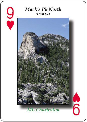
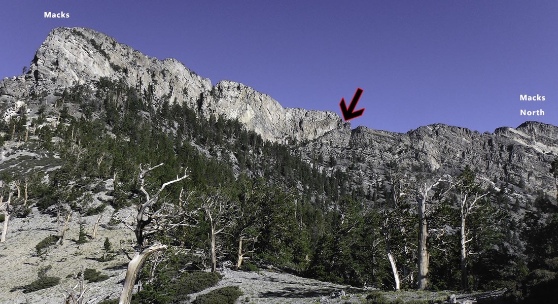
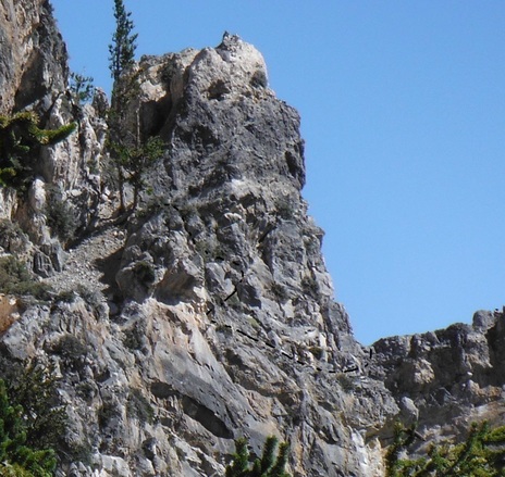
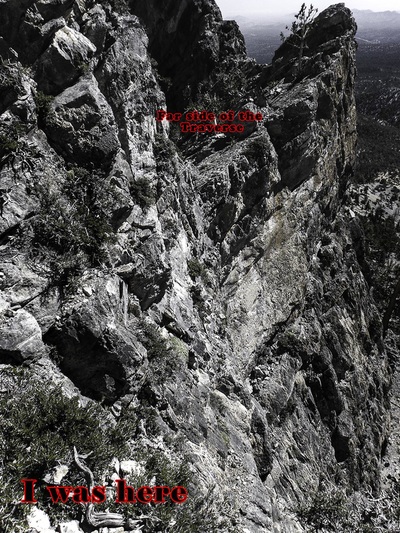
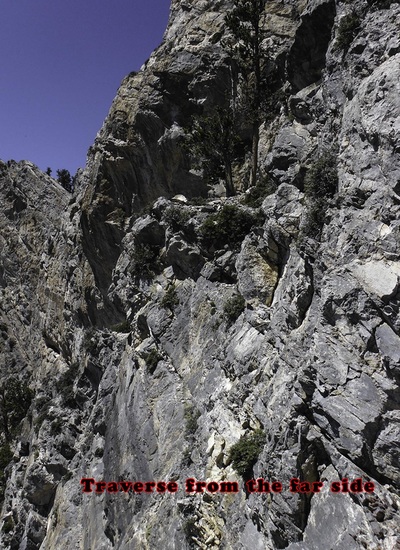
A few years ago leaders of the 52 Peak Club found a route to Mack's North Peak starting from Mack's Canyon Road. This was a big improvement, but the route had a long and loose traverse (not dangerous, just aggravating) all the way around to the north side of the mountain. On top of that the descent route had a lot of elevation gain! That should be hiking illegal :) A Discovery!I had been hiking to Mack's Peak for 20 years. The other day I was looking at a photo of Mack's when I noticed a ramp that was about halfway between Mack's Peak and Mack's North Peak. I thought this would be the perfect route to Mack's North Peak. It would be very direct and would eliminate the need to first hike to Mack's Peak. The ramp in the photo was an easy class 2 ascent, but then there was an extremely loose 100 foot climb. The climb was only class 3, but you couldn't trust any handholds. I put up three ropes, but it was still a very sketchy climb. The top of the ascent met up with the original Mack's Peak Traverse route, which at this point weaves around to the NW and looses about 400 feet in elevation. The Ultimate Route or Is It?I did not think the route I found was safe, especially for a group hike. Upon looking at photos, I saw what appeared to be the ultimate route. It would eliminate the 400 feet in elevation loss, avoid the loose ascent and save at least 40 minutes! This would be my greatest find in the Mt. Charleston area. But First...I had to take down the ropes and cairns that led to the extremely loose 100 foot climb. It was too dangerous and not practical. There's an old saying in screenwriting: You have to kill your darlings. It applies to most things in life. Once I had taken down the ropes, then I could complete the ultimate route to Mack's North Peak! Here I Go:So DH and I set off to find what would be an amazing route to Mack's North Peak. The night before I studied a photo that showed our potential route. Although it might look sketchy in the photo, I know from 20 years of finding routes that you do not know if it goes until you try. We ascended the ramp and started looking for the traverse in the photo. And then we saw it... The Moment of TruthFrom the photos and video below it's obvious this is a death traverse. It's extremely exposed, very difficult, and the rock is rotten. It was just 25 yards from far and safe side of the traverse. In fact the cairn on top of the boulder is one I made! I had been to the far side of the traverse several times via the normal Mack's Traverse route. Bottom line: Sometimes 25 yards are too far. This is one time a route did not go. I was very enthusiast, but I can't let that cloud my judgement. This lesson pertains to all aspects in life. So this route is a no-go, unless... In this post I will list a plethora of hiking resources for hikers. These resources will be broken down into different categories. This is not an exhaustive list; I am sure I missed some resources, but I believe you will find these valuable. Enjoy and use. Online Hiking InformationHikingLasVegas.com (http://www.hikinglasvegas.com/) – my own website that has been on the internet since 1998! It has over 100 pages of hiking information focusing on hiking around Las Vegas. There are both free and paid sections. The paid section allows members to download over 400 step-by-step directions of hikes all over the Southwest. I have done every hike on my site, no exceptions. SummitPost.org (http://www.summitpost.org/ )– another online website that features route descriptions from all over the world. The quality of the descriptions range from good to very poor. Be careful when using the hike descriptions. Anyone can add a route description. Trails.com (http://www.trails.com/ ) – Over 57,000 hike descriptions. This is a paid service. The website focuses on trails, not routes. You will not find hikes such as: Ice Box Peak, Pine Creek Peak, Holiday Peak etc. AllTrails.com (https://www.alltrails.com/ )- Search over 50,000 trails with reviews and photos curated by 3 million hikers, campers and mountain bikers like you. You will not find hikes such as: Ice Box Peak, Pine Creek Peak, Holiday Peak etc. Peakery.com (http://peakery.com/) – online database of peaks around the world that you can keep track of the peaks you climb. Backcountry Post - (http://backcountrypost.com/) Another community site where you can post trip reports and photos. WeatherWeather Site: (http://climbingweather.com/nevada) weather information for hiking areas in NV. Nation Weather Service (http://www.wrh.noaa.gov/vef/) Link set to Las Vegas. You can zoom to any location and get very accurate information. Social MediaYouTube: https://www.youtube.com/user/BranchWhitney Over 250 hiking videos, hiking tips, and product reviews for you. Hiking Las Vegas Facebook: (https://www.facebook.com/home.php?sk=group_68936636102) Very active Facebook hiking group. 3000+ members. Photos and information about hikes around Las Vegas and beyond. Members can share hiking tips, trips, and photos. Online ShoppingSierra Trading Post (http://www.sierratradingpost.com/): Great selection and prices. Campmor: (https://www.campmor.com/): Great selection and prices. Amazon: Do I really have to say anything J Retail StoresREI: (710 S Rampart Blvd and 2220 Village Walk Drive Suite 150) great selection and return policy. Staff is very helpful and knowledgeable. Desert Rock Sports (8221 W. Charleston Blvd) – good selection of hiking and climbing gear. Staff is very knowledgeable. Hiking ClubsThe 52 Peak Club (www.52PeakClub.com): for advance hikers who want to hike/scramble to the best 52 Peaks around Las Vegas. We average 60+ hikes per month. I created the 52 Peak Club. Las Vegas Mountaineers Club: (http://www.lvmc.org/ ) One of the oldest hiking clubs in Las Vegas. They offer hikes and climbing outings and teach their members outdoor skills. Hiking BooksHiking Las Vegas. Covering Red Rock Canyon, Mount Charleston, and Lake Mead, Hiking Las Vegas is the definitive all-encompassing guide to the best outdoor adventures surrounding Sin City. The hikes range from relaxing trails perfect for families to challenging climbs for advanced daredevils. I am the author You can buy it from Amazon or locally at REI. Hiker's Safety TalksAug. 29th at 6:30 pm at the Windmill Library
Sept. 22th at 6:30 pm at the Rainbow Library These are given by Branch Whitney and are free to attend. |
AuthorBranch Whitney is the author of Hiking Las Vegas and creator of the 52 Peak Club where members hike to the best 52 Peaks around Las Vegas, NV Archives
October 2023
Categories |




 RSS Feed