The background of this area should be an image. Please use Change Background feature to change the background of this area.
(Can be found under DESIGN tab)
Hiking Las Vegas Blog
|
Let's look at that statement! First, is the descent route the same as the ascent route? There are some peaks that you (probably not you, but others) can opt to take a tram down. And, wait for it... maybe even have in beer in the tram!!! Other summits have a much easier descent route. Let's talk about Windy Peak, East Face route, in Red Rock Canyon. The East Face route is a tough, exposed route that not a lot of hikers would want to descend. If they opted for following the Windy the Backside route (mostly a trail hike), then the descent route is much easier and faster. The summit, in this case Windy Peak is much more than halfway. So, why do experienced mountaineers etc. make that statement? They are telling you that you need to have something left in the tank to get off the mountain. That is true but... Normally descending is easier overall than ascending. Here's why: Descending is much easier on your cardiovascular system (heart and lungs) then when you are ascending. For most hikers it's their cardiovascular system that gives them trouble on the ascent. I am not talking complete failure, but where the hiker slows down or even quits and descends. For you, and I really mean you, I will play Devil's Advocate!
Descending is tougher on the knees. That's why smart hikers use their arms while descending. It takes pressure of their knees. Hikers are more tired while descending. True, after all they just climbed 2,000, 3,000 feet or more to the summit. Their balance is not as good. Tired leg and core muscles decrease balance. Research shows majority of accidents happen during descents. All good points, but I wonder how many accidents result from losing focus? I don't know the answer, but I bet a higher percentage of accidents occur because of losing focus. For me, I don't relax until I am in my car. Bottom Line: When you are at the summit, you are only halfway there is good advice, but like everything in life, it depends on the circumstance or in this case the summit and the available routes you can descend. Agree, disagree? Make a comment. Thanks for reading! Hiking boots/shoes are expensive. You want them to last a longtime, don't you?
I have a 3 Point strategy to do just that! 1. Wear your best, newest, rock scrambling shoes when doing serious scrambling routes. Ice Box Peak, White Pinnacle Peak, Pine Creek Peak, and Terrace Canyon Peak come to mind. All of these routes are in Red Rock Canyon. 2. After a period of time the soles of those shoes wear down. Here's what you do: Use them for easy hikes, such as: White Rock Springs Peak, Kraft Mtn. etc. 3. When those shoes get really bad, use them for Charleston hikes, Lake Mead hikes or trail hikes. Charleston rock (limestone) is very tough on the sole of shoes. When your shoes really get trashed (stitching blown out, etc.), throw them in the trash. So I have three pairs of shoes I use depending on the hike. Hope this advice saves you money. You can also buy ugg boots online. On Feb. 7th, the 52 Peak Club did a hike to First Creek Peak. Normally this is a fun hike with lots of scrambling, but on this day there was ice high up on the route. Not surprisingly the ice was on the north facing side. This made things tricky and safety was the utmost thing on our minds.
Things Get Tricky and We Used Some Tricks The higher up we climbed the more snow and ice we encountered. Luckily we were in fairly tight chutes, so we could use the walls for handholds and there was no exposure. Once we turned the corner and came to the ledge things changed. Ahead of us was a very exposed climb that had ice on it. A fall here would be deadly. Walking the ledge normally was no big deal, but with ice on it and a death-fall off to the right, it was a big deal. We were close to the summit and did not want to turn around. We took rocks and started chipping away at the ice to the sandstone rock underneath. It worked! We carefully and successfully traversed the ledge. At one point we laid down a roped to make it safer. Summit Block After carefully hiking up the snow covered ground, normally this is an easy hiker's path, we stood at the base of the imposing summit block. We were all glad there was no ice or snow on this final climb. At the summit we rested, it had been a tough hike and looked across the canyon to the Hidden Bowl on Mt. Wilson. Not a speck of snow or ice, since it was south facing. Hmm... Decision Time We all realized descending the route we ascended would be very tricky and dangerous, even with webbing and cams. Most accidents happen during the descent. We made a group decision to traverse over the Hidden Bowl. The traverse was long, but very safe. We descended the Hidden Bowl back into the wash. Bottom line is we all made it out without incident and had a memorable hike. Better decisions lead to better hikes and a better life. This one example. With part of Lovell Wash now private property the old route to Anniversary Narrows is not accessible. On Friday we were met by a security guard, who was friendly and informative. Below is the alternative route into Anniversary Narrows.
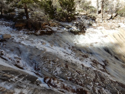
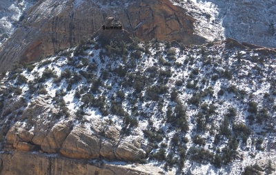
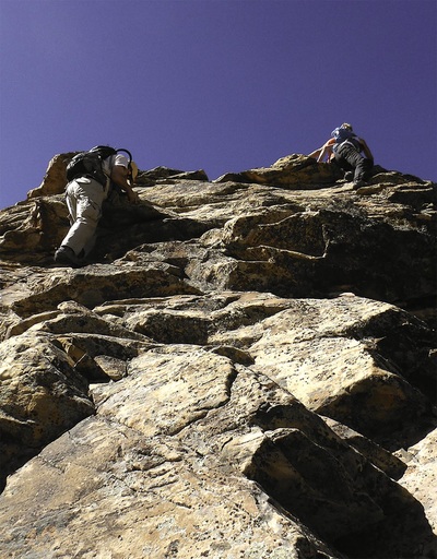
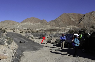
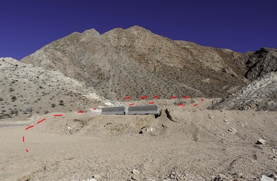
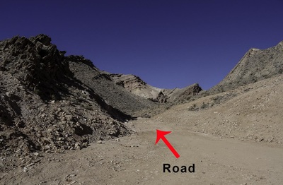
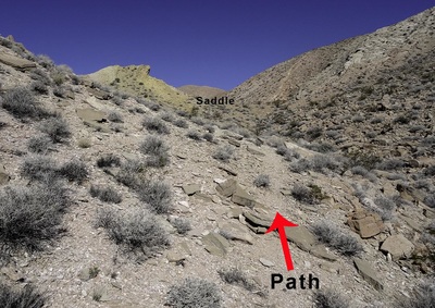
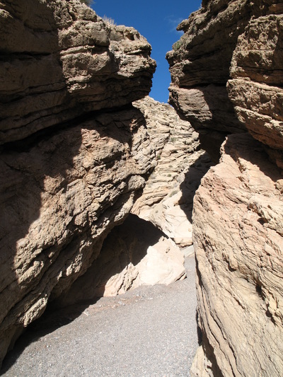
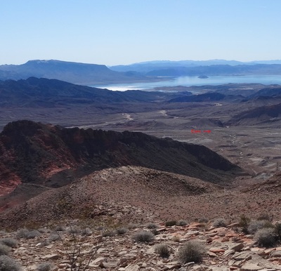
Here are easy directions to hike Anniversary Narrows: From Northshore Road turn left on Callville Wash North Road (94) at MM 16 and drive 0.9 miles to the new trailhead shown in Photo 1. A cairn marks this trailhead. There's room for about six cars. Although you could drive a car to this trailhead, a high clearance vehicle is recommended. The Hike: Follow the wash in Photo 1 making sure to always stay in the main wash. At about 1.5 miles the wash narrows and does a 180 circle. Climb out of the wash before it starts making the 180 circle to the view in Photo 2. Veer right passing the concrete blocks (they might not be there) to the road in Photo 3. The road is about 75 yards from the concrete blocks. Go left on the road (I set a cairn here). The road soon fades into a drainage. When the drainage divides, go right and follow a path on the left side of the drainage to a saddle. Large cairn here. Drop down the far side of the saddle into a drainage. Although the drainage is easy (Class 2) it's about 0.25 miles until it drops into Lovell Wash. Turn right and walk 80 yards to the start of Anniversary Narrows. Photo 4. Insights: Don't listen to people saying how difficult the final drainage is to descend. For experience hikers it's a piece of cake. This new route adds at least 30 minutes to the hike. For hikers only wanting to do Anniversary Narrows this might be too much, especially if they have young children. If doing Anniversary Narrows Peak, then this is not that big of an issue. Descending From Anniversary Narrows Peak: Dinorah showed me a much better descent than I have done, which is perfect for where you park at the new trailhead. From the peak you can see your car(s). Head toward your car. From the peak veering to the right will get you on some nice slabs. Continue descending into a drainage. There appears to be a couple of drop-offs, but upon closer inspection they are very easy to downclimb. You will come to a major drop-off. Head right to bypass. No matter how you descend around this drop-off, it's pretty loose. Once down stay out of the wash paralleling it, until it becomes obvious that dropping into the wash is the best route. Continue in the wash about one mile back to your car. This part of the descent is very easy and fast. My Final Verdict: This new route is not as easy or fast as the original route, but it is still worth doing Anniversary Narrows Peak. The new descent route is quicker than the other two descent routes, which is a plus. Note: Once past the Narrows I turned right at the first cairned drainage. I normally walk another 0.5 miles and follow the standard route. This new route is shorter distance wise, but I don't think it's shorter time-wise. The last 30 yards before the saddle that overlooks the Bowl of Fire is extremely loose. This is a big downside. |
AuthorBranch Whitney is the author of Hiking Las Vegas and creator of the 52 Peak Club where members hike to the best 52 Peaks around Las Vegas, NV Archives
October 2023
Categories |



 RSS Feed